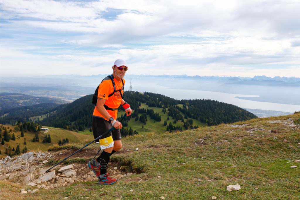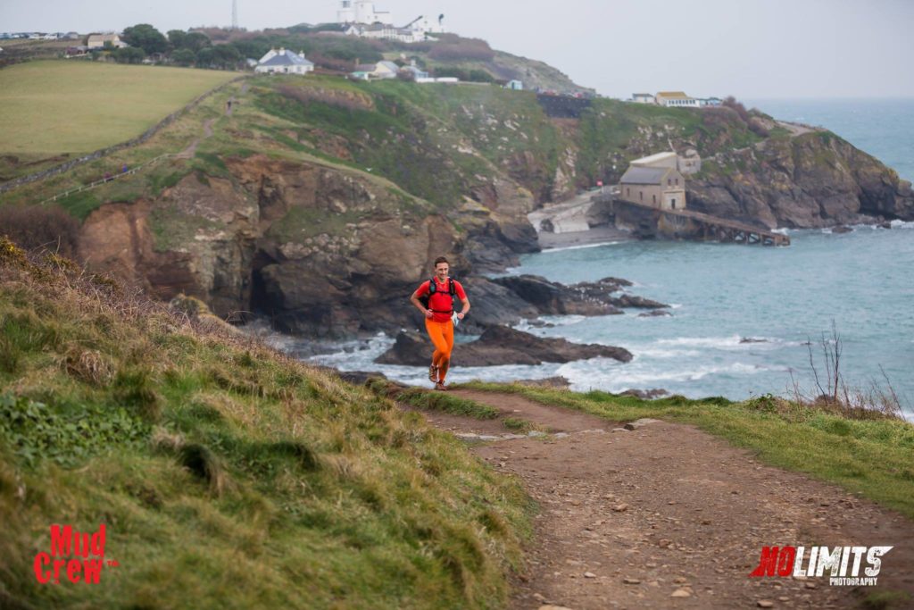
A runner tackles one of the more gentle ascents
I remember when I was a kid in the 70s and my parents would drive us down the M5 to Cornwall for the summer holidays.
After sitting in stationary traffic on the motorway outside Exeter for the first few days, we would finally arrive at the campsite or rented cottage and don our walking boots to stroll along the South West Coast Path. The sun was out, the sky was blue. Perhaps we’d buy an ice cream and play on the beach at St.Ives. Maybe we’d drive up to Land’s End to enjoy the view or stand in awe of the cliffs at Lizard Point. Good times.
Little did I know then that one day I would be back. In the dead of winter, in the black of night, I would revisit those nostalgic places of our youth on a 100-mile race that would last up to 36 hours for some, but feel like a lifetime for everyone.
The only similarity being that this time, many of us would still be wearing shorts.
The Arc of Attrition, organised by Mudcrew, follows the South West Coast Path from the village of Coverack on the south coast of Cornwall to Porthtowan on its north coast. It is approximately 100 miles, although many suggest it’s further.
Elevation ranges from 3,000m to 5,000m, but is officially 4,010m. Suffice to say, this is not a race for the beginner. In fact, you are required to have completed a minimum 100K distance before you can even apply.
On top of that, there is a strictly enforced mandatory kit list, which includes a survival bag. Not just a space blanket, but an entire body-cover survival bag. The importance of this came into sharp focus in 2016 when 75% of those that started did not make the finish. Driving rain and storm force winds battered them into submission, and only 28 hardy competitors crossed the finish line.
This year the weather looked almost tropical by comparison. I arrived at registration in Porthtown with the temperature at a balmy four degrees, although I was not taking anything for granted.
The Blue Bar at Porthtowan doubles as both Race HQ and the finish line. Runners are then bussed to the start after registration and the race briefing.
By 9am I had successfully passed kit check and been issued with my race number. The next job was to have a GPS tracking device fitted to my backpack. This would be continually monitored
throughout the race and if I stopped moving for more than a few minutes, at anywhere other than a checkpoint, the team at Mudcrew would start making enquiries as to my wellbeing.
Furthermore, if I were to press the button on the tracker, an emergency rescue helicopter would be dispatched. “Last year, someone managed to press the button in the car park before the race had even begun” says Race Director Andy Ferguson by way of warning.
Most normal race briefings go something like this. “Please do not drop litter or you will be disqualified. Shut gates behind you, and there are a few pregnant cows around so do steer clear of them if you can. Have a great race everyone.”
The race briefing for the Arc of Attrition 2017 included such gems as, “Don’t wander off the path because there are numerous abandoned tin mines out there and the trackers don’t work at the bottom of a mine shaft,” and, “You’ll be running on some exposed cliff edges so make sure your headtorch is working and turned on during the 13 hours of darkness”.
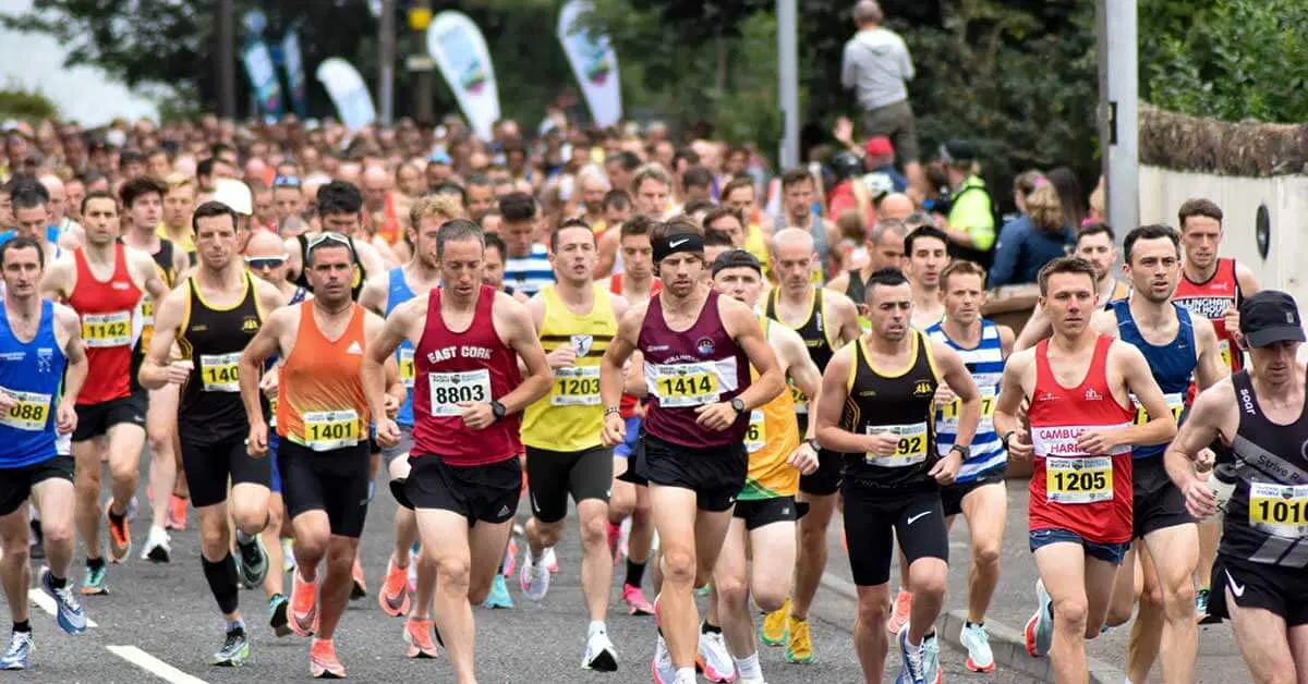
With that, 109 of us boarded the buses. We had an hour’s journey to Coverack. An hour in which to contemplate what lay ahead.
I had goals, but no expectation that I would achieve them. I had fears but every expectation that I should overcome them.
As well as running the race, I would be carrying a camera and trying to document my experience. This comes with its own set of problems over and above the actual running. Achieving good-quality sound in howling wind meant carrying a separate audio recorder and mic.
In order to get stable footage I needed a gimbal, which is basically a heavy, battery-powered selfie stick. I needed extra camera batteries, spare SD cards and a spare camera in case one packed up. Along with two headtorches, survival bag, other clothing and water bottles, this made for a rather weighty Salomon vest!
Suitably wrapped up against the ever increasing wind, we set off at just after midday. After a few hundred metres on the road and a short climb, we were on the coastal path.
The terrain was almost immediately uneven, the mud claggy and the elevation intense. In the first 10 miles to Lizard Point, my Garmin clocked me at over 600m total gain.
One minute we would be high up on the cliffs with stunning views along the coast. The next we were on a rocky beach timing our run across the cove to avoid the oncoming waves. It was windy and cloudy, but bright with no rain. I had settled into the middle of the pack and pressed on.
The running between miles 10 and 24 was much easier than the first 10 and I was ahead of my very loose schedule when I arrived at the first checkpoint at Porthleven. The course was split by four official checkpoints, all of which were located indoors in pubs or hotels and all served hot food. However, there were numerous points on the course where a runner’s own crew could provide additional support.

Blisters to be expected
Despite having to look after our two small children, my wife, Victoria had agreed to crew for me. I’m afraid I am guilty of requesting a monumental effort on her part, to meet me at some 15 locations along the route.
Soon after leaving Porthleven, the light was gone. Headtorches donned, we made our way 14 miles round the coast to Penzance and the second official checkpoint at 38 miles.
Penzance is a fair-sized town and running in, and then out the other side, made for a good few miles of flat, urban running on roads and paths. In the grand scheme of things, it didn’t last long and we were soon climbing hills, traversing streams, crossing little wooden bridges and climbing over boulders again.
The Arc of Attrition is a self-navigation race, which means for most of the course the event organisers don’t place any direction signs along the route.
The good news is that the South West Coast Path is relatively well marked as it is. All you have to do is keep following the little acorn sign. Simple, yes? Well, not if you are me apparently.
What’s annoying is that I even had the route map on my watch to refer to. I just didn’t refer to it often enough, and as the night drew on I regularly found myself 500 metres off course on another path and would have to track all the way back.
On one occasion I led two other runners up a huge incline only to find we had to come all the way back down again. A little later, I followed a chap who looked like he knew where he was going, only for him to lead us both into bramble bushes up to our chests. I made it to Land’s End and the third checkpoint still feeling strong, but now behind where I had wanted to be in terms of time.
The temperature had started to drop significantly and we were approaching the most technically demanding section of the course. I downed a bowl of chicken soup and considered changing
my socks. It felt like too much effort, so on I went. Having run with people on an off for much of the race thus far, by now it was thinning out considerably. I was to learn later that by Land’s End or before, 23 runners had dropped out.
I set off down a path out of Land’s End at around 2am. I got about 400m down the path and panicked that I had gone wrong again. I walked back up, only to find I had been right all along.
Caught in a downpour
Parts of this next section between Land’s End and Pendeen Watch were very boggy. However, 60 miles into a 100-mile race you start to care very little whether your feet are wet or not. In fact, sometimes it can be a real relief to put your feet in icy cold water. If you’re wearing good shoes and socks, they should drain quickly so you won’t carry the extra weight of waterlogged footwear for long.
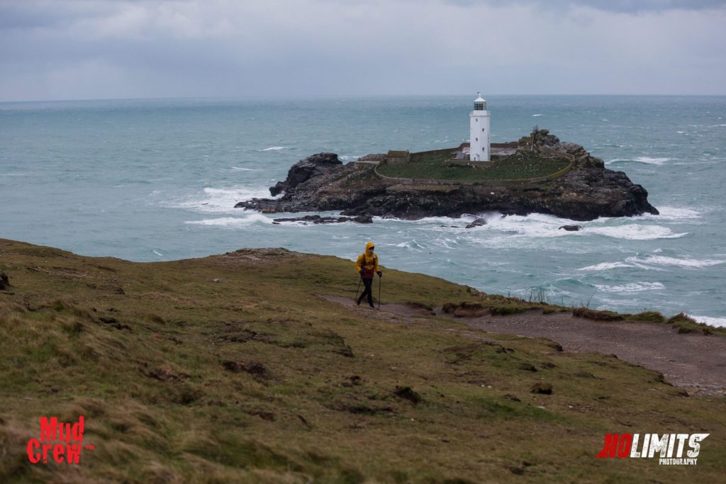
By now, my Garmin was reporting 3,000m elevation and it was only about to get worse. It was still dark at 65 miles when I saw Victoria at Pendeen Watch Lighthouse, before I headed out for a 14-mile section to St.Ives that is the most difficult and technically challenging on the course. It’s also the most remote, so any problems here and you’re on your own for longer than you might be otherwise.
Thankfully, it was during this section that dawn finally emerged. Although this made navigation easier, I was now seriously slowing down. My wife Victoria had been there for me every seven miles or so to give me a pep talk and send me on my way.
Now I was alone, hardly able to run at all on the terrain and willing St.Ives to appear round the corner with every step I took. In other news, I was now also suffering hallucinations. “There are sheep over there”. No, just some small white rocks. “There’s an old woman bending over a wall”. No it’s foliage. “Look, a tank!” No, a tree. I eventually got used to this and found my sub-conscious’ creative imagination rather entertaining.
It took forever, but at last, in the middle of a hail storm, I arrived at the final checkpoint in St.Ives. The worst was over, but those 14 miles had taken me over five hours. My loose schedule had been to try and finish in 26 hours. That was now long gone. The next target was to get in under 30 hours. If you can finish the Arc of Attrition in that time, you achieve their coveted gold buckle. After 30 hours it’s silver.
I had six hours, on leaving St.Ives, to cover 22 miles. In any normal race, under normal circumstances, 22 miles in six hours is almost a given. But when you’ve run 78 miles immediately before, through the night, in freezing temperatures, across some of the most challenging terrain anywhere in the country, it’s by no means a certainty.
Thankfully the first six miles between St.Ives and Hayle was flat and fast. I made every effort to cover this as quickly as possible and managed to pass a few tired legs as I went.
The sand dunes from Hayle to Godrevy are the only section of the entire course that Mudcrew mark out to help you navigate. Running through sand doesn’t sound good news at all, but it was surprisingly easy given what had gone before.
With 11 miles to go, I was back on the hills. This time though, the trails were much more like those you would find on any ‘normal’ trail race. I was running and walking, running and walking the best I could, but I could feel my legs were done.
When I arrived at a huge valley with 6 miles to go, my heart sank. I thought, there’s no way I can do it now. Hobbling down the steps and crawling up the other side was about the best I could muster.
It’s amazing, though, what a dose of adrenaline can do. I arrived at my final stop in Portreath, a broken man, believing I had five miles to go.
Victoria thrust a coffee in my hand and one of the Mudcrew staff, Andy, told me I had 3.5 miles to go. That was it. It was all the motivation I needed to fair sprint for the line.
There was, however, one final hiccup. Andy had meticulously told me exactly where to go to get out of Portreath and back onto the coast path. But in my delirium, I hadn’t heard a word he had said and I ended up knocking on the door of some random house at the top of the village to ask where I was supposed to go.
Eventually back on the coast path, I ran as fast as my legs would carry me. Those last three miles turned out to be four miles and were not without two final stings. Two more valleys to traverse before the final drop into Porthtowan. At the top of the hill I shouted to a bystander to ask the time. I had 10 minutes to get down the hill, round the village and back to the Blue Bar.
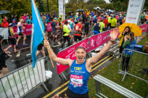
Thankfully, it really wasn’t far and I crossed the line just before darkness fell after 29 hours and 50 minutes of a 100-mile race the like of which I have never experienced before.
Watch the short film Stephen made: